Description of climate
|
Haiti has a tropical wet and dry climate. However, the climate is semiarid where mountains in the east cut off trade winds creating a rain shadow due to orographic effect.
Temperatures are typically warm, and average around the high 70s°F in January and February to the mid-80s°F in July and August. Since a lot of Haiti's rural area is mountainous, temperatures are often dependent on the elevation of the area in Haiti. HIgher altitudes will have cooler weather while lower altitudes will have warmer temperatures. Because Haiti is located on the leeward side of Hispaniola, the humid trade winds do not impact the climate as much as they do for the Dominican Republic. However, Haiti is still in the hurricane belt and has many tropical storms. The average annual rainfall is about 140 to 200 centimeters, but it is unevenly distributed. The most humid areas are found on the southern peninsula and in the northern plains and mountains. The driest regions is the northwestern coast. The altitudinal zone of Haiti would be mainly tierra caliente in the lower elevations and tierra templada in the higher elevations. Tierra fria zones can be found in the mountainous ranges. |
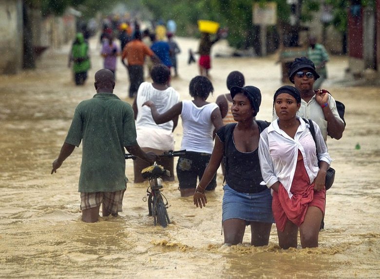
Tropical Storm Isaac (2012) drenched the southern peninsula of Haiti
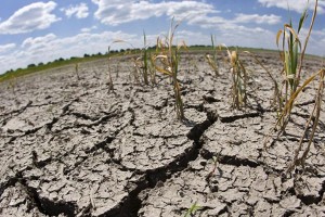
Droughts are a side effect of varying annual precipitation, as shown in northwestern (Haiti 2014)
|

Deforestation has been a problem for Haiti since 1804, after their independence

Wood is a popular and accessible energy source
|
Factors affecting climate Some factors that affect the climate of Haiti are deforestation, elevation, continentality, and the burning of natural resources. Haiti has gone through major deforestation to clear land for agriculture and for resources such as firewood. The pollution released during deforestation can alter precipitation rates as well as temperatures. The soil degradation that is a result of no tree roots hold down the soil, increases the chances of flooding during periods of heavy rainfall. The abnormal patterns of rainfall that can be a result of the air pollution from deforestation can also create either flash floods or droughts . Plus, firewood is a huge energy source in Haiti and when burned, releases even more carbon dioxide into the air leading to more air pollution.
Haiti's proximity to the water has lead to an overall high humidity and constant temperatures. Varying elevations in this mountainous country can also impact the climate. Higher elevations mean colder temperatures, while lower means warmer. Also, mountains in the east block trade winds, leaving one side very humid and the other dry through the orographic effect. |
Climograph
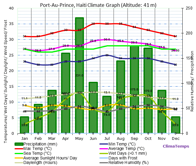
This climograph of Port-au-Prince, Haiti shows generally warm temperatures throughout the year. The temperatures do not have great variations throughout the year, which may have to do with Port-au-Prince's proximity to water. There is no distinctive winter season, except when temperatures decrease from November to February at an average of 26.5 degrees Celsius. The highest temperatures range from June to August at an average of 29.5-30 degrees Celsius. The levels of precipitation are highest during May, but are consistently high from August to October. The lowest levels of precipitation are in December and January. The climate of Haiti, specifically this region would be tropical wet and dry. This is because of the wet and warm season (August to October and April to May) that can be distinguished from the milder, drier winter season (November to February). Port-au-Prince would be in the tierra caliente zone, since it is at an altitude of 41 m.
